GIS forLaw Enforcement
Modern law enforcement takes advantage of smart maps—visualized information and location analytics—to empower frontline officers and commanders with better decision making. It’s simple. Maps make information actionable. Esri technology makes it easy to integrate every data type and apply advanced analytic tools for solving problems, predicting crime, and protecting citizens.
Solutions
Command staff need to make informed decisions. Esri gives you the ability to improve planning, reduce costs, and increase transparency. With the Esri location platform, your department can apply the power of geography to organize, visualize, and disseminate mission-critical data. Use map analytics to make informed personnel decisions and accomplish strategic planning objectives. Engage the public through a variety of citizen engagement maps and apps.
|
|
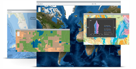
ArcGIS Platform ArcGIS is the location platform for your law enforcement agency, enabling you to create, organize, and share information and tools with anyone. Develop intelligent online maps and useful apps that run anywhere your staff operate—on desktops, the web, smartphones, and tablets. |
| ArcGIS Online Use Esri technology to make smarter, more informed decisions and plan for long-term change. ArcGIS Online gives command staff and planners the ability to make maps and perform analysis in a collaborative environment that streamlines the planning process. |
|
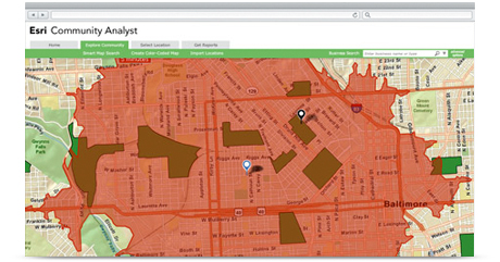 |
Esri Community Analyst With Community Analyst, you can optimize resource allocation choices, understand the types of people impacted by policy decisions, and learn more about the demographics of high-risk communities. |
As more agencies extract data from computer-aided dispatch (CAD), record management systems (RMS), and all the other police systems and sensors, law enforcement personnel can struggle to make sense of it all. With the ArcGIS platform, your department can derive meaning from large volumes of data so that crime patterns—and the appropriate policing strategies—become evident. Ask questions and build an accurate picture of what’s happening so command staff can identify needs fast and improve mission readiness.
|
|
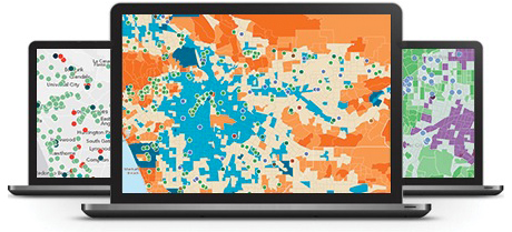
ArcGIS Platform The ArcGIS platform enables crime analysts to track current and historical crime data. Predict future crime trends using location analysis to uncover patterns. Use a scalable platform to share insights with everyone in your agency. |
| ArcGIS Online Give officers and the community the power to perform simple self-service crime analysis tasks. With ArcGIS Online, anyone inside or outside your organization can create a user-defined area of interest, select crime types that are important to them, and create their own reports and interactive maps. |
|
 |
ArcGIS for Law Enforcement Analyzing crime is made easy with ArcGIS for Law Enforcement. Geoenable the work your analysts do in support of patrol, administration, and special teams and operations. Access templates that support incident analysis, planning, and sustenance. |

Managing special events and operations is an ever-increasing part of the law enforcement mission. Whether these events are planned or not, preparation is the key. Esri can help you plan for the worst, with spatial solutions that support initial planning, tactical operations, and final debriefing. Map staging areas, officer locations, assets, and vehicles required to accomplish the mission.
|
|
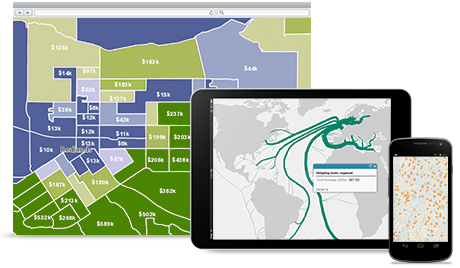
ArcGIS Platform The ArcGIS platform supports special event operations from the initial planning stages to the operationalization of each plan. Build dynamic, real-time maps in the command post or the field, and share operational intelligence with all your stakeholders. |
| ArcGIS Online ArcGIS Online delivers event planning information to the public in the form of web mapping applications. Get important updates to the public fast with easy-to-configure public information web app templates. |
|
 |
ArcGIS for Law Enforcement Put ArcGIS for Law Enforcement to work for your incident operations personnel. Harness incident and special-event planning templates to streamline the collection of data about hazards, equipment, supplies, and procedures. Ready-to-use mapping applications help you plan for potential incidents and manage crises. |