GIS forDefense
Enable Mission Success with Authoritative Information
Militaries rely on geospatial awareness for virtually every aspect of operations. From mission command to intelligence, surveillance and reconnaissance (ISR) to training area management and mission support; geospatial information plays a strategic role. Esri provides geospatial solutions to meet the needs of armed forces. With Esri technology, you can quickly visualize information, perform analysis, and make better and faster decisions.
Solutions
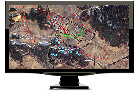
Esri supports military intelligence analysts with a platform for advanced analytic methodologies and innovative tools. With ArcGIS, you can work with multiple sources of information to produce timely, accurate, and actionable intelligence for decision makers. Take advantage of a common platform to turn the data you have into the intelligence you need.
|
|
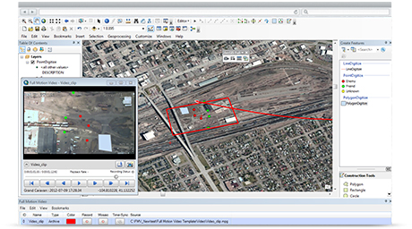
ArcGIS Pro The foundational platform for Esri’s geospatial solutions for the military is ArcGIS Pro. It provides the core technology to collect, process, exploit, and share information necessary for a variety of activities and missions. The platform also supports Esri’s software solutions developed for military and intelligence activities. |
| ArcGIS for Defense Create maps and related services for the visualization and analysis of the battlefield environment. Reports and intelligence information can be easily combined to visualize threats and respond to emerging situations. |
|
|
|
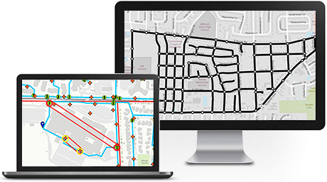
Operations Dashboard for ArcGIS Create and share operational views. These include interactive maps, real-time data feeds, lists, charts, gauges, and other performance indicators. Based on live geographic data, they can be included in a web map or web service. Use maps with dynamic data sources to provide real-time views. |

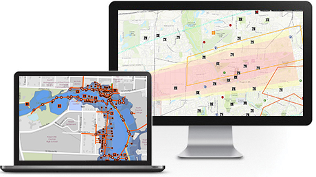
Manage and maintain a complex collection of facilities, lands, and services. Using Esri geospatial technology, you have a comprehensive view of all of these assets. In addition, you can access and analyze detailed information for maintenance and replacement purposes, which facilitates the annual budget review and approval process.
|
|
ArcGIS Pro The foundational platform for Esri’s geospatial solutions for the military is ArcGIS Pro. It provides the core technology to collect, process, exploit, and share information necessary for a variety of activities and missions. The platform also supports Esri’s software solutions developed for military and intelligence activities. |
| Esri Production Mapping The shared work environment capabilities of Esri Production Mapping allows you to improve the quality and value of your geospatial data and cartographic products. These improvements include standardization, repeatability, and the configuration of production processes. |
|
|
|
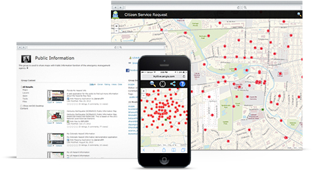
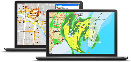
ArcGIS for Emergency Management ArcGIS for Emergency Management enhances disaster mitigation and response for military installations. Using spatial analysis and visualization, build reports that can be continuously updated and customized for various stakeholders. Visualize threats and other situations for rapid decision-making. |
Your activities require accurate maps and mission information. Esri’s geospatial technology provides a platform that allows you to fuse disparate data for location-based analysis and collaborate with mission partners. You can apply maps and analysis to many areas of operational readiness including logistics, personnel, health, special investigations, and training. Change the way you accomplish your mission with geospatial technology.
|
|
ArcGIS Pro The foundational platform for Esri’s geospatial solutions for the military is ArcGIS Pro. It provides the core technology to collect, process, exploit, and share information necessary for a variety of activities and missions. The platform also supports Esri’s software solutions developed for military and intelligence activities. |
| ArcGIS for Emergency Management Create maps and related services to facilitate the visualization and analysis of disaster areas to mitigate damage and speed recovery. ArcGIS for Emergency Management provides templates for common emergency workflows so that reports and intelligence feeds can be easily included in the situational analysis for rapid decision-making. |
|
|
|
Operations Dashboard for ArcGIS Create and share operational views. These include interactive maps, real-time data feeds, lists, charts, gauges, and other performance indicators. Based on live geographic data, they can be included in a web map or web service. Use maps with dynamic data sources to provide real-time views. |