GIS forEmergencyManagement
When a disaster strikes, knowing what you need and how to find it can be the key factor that saves lives, resources, and critical infrastructure. Esri can help you with all phases of emergency management, from developing mitigation plans to managing limited resources in the midst of chaos and prioritizing recovery efforts once the dust settles. Maintain shared situational awareness across multiple jurisdictions on any device and get the geographic edge for your emergency management with Esri.
Solutions
Preparedness is the first step to any successful emergency management outcome. With Esri, you can immediately visualize critical infrastructure and vulnerable populations within your community that you need to protect when disaster strikes. Identify and prioritize potential threats, both environmental and man-made, and develop comprehensive plans for evacuations, containment, and mitigation. Find your greatest weaknesses and arm yourself for the next big incident.
|
|
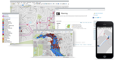
ArcGIS for Emergency Management Take the guesswork out of your disaster planning with free map and app templates in ArcGIS for Emergency Management. Quickly deploy focused apps that can help you with everything from special- event planning to developing flood response plans. |
| ArcGIS for Desktop Take advantage of scientific analysis tools and modeling capabilities in ArcGIS for Desktop to better understand how various threats will impact your community. From animating chemical plumes to optimizing evacuation routes, ArcGIS for Desktop provides a powerful suite of tools that can help you develop and test your disaster plans. |
|
|
|
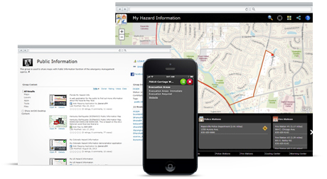
ArcGIS Online Disaster and emergency management plans are useless unless people can access them. With ArcGIS, you can find authoritative data for your plans and create web maps and apps that can be shared across your organization and with partner agencies. Boost your community’s preparedness with story maps that communicate disaster plans. |

Before you can start directing resources, you have to know the situation on the ground. With Esri technology, you can create a common operational picture for responders and supporting agencies that provides a single, current view of the situation. Share information and collaborate with internal stakeholders to make sure everyone is using the most recent and most accurate data when it matters most.
 |
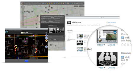
ArcGIS for Emergency Management Don’t waste time trying to establish your own information-sharing apps during an emergency. Preconfigured templates like the Common Operational Picture and the Incident Briefing Book in ArcGIS for Emergency Management let you share data in a matter of minutes. |
| Operations Dashboard for ArcGIS Fuse your common operational picture with interactive charts and streaming data to monitor the situation as it emerges. With Operations Dashboard for ArcGIS, you can track weather, responders, hazards, and more, in a single, dynamic view. Equip your leadership with a straightforward view of information that will help them allocate limited resources. |
 |
 |
ArcGIS Online Create interactive web maps and apps that bring volumes of data into a common view. With ArcGIS Online, you can easily share your authoritative information with other agencies or find live data such as weather or fire perimeters. Take advantage of groups and manage user roles to securely expose sensitive information to those who need it. |
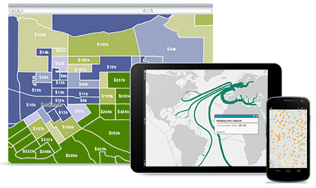
At its core, effective emergency response is about directing limited resources to the places where they can do the most good. Intelligently dispatch first responders and optimize supply routes through powerful spatial analysis and visualization. Find the best sites for shelters and incident command posts while constantly keeping an eye on the situation with live data feeds from the field.
|
|
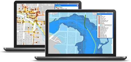
ArcGIS for Emergency Management Manage your response and achieve better situational awareness with live feeds of operations. With ArcGIS for Emergency Management, you can use free templates to quickly produce mission-critical maps and apps that drive more effective emergency response. |
| ArcGIS Online Maintain situational awareness at all times with live feeds and authoritative sources from other agencies. ArcGIS Online provides a geographic framework to monitor the evolving nature of any situation and visualize the locations of your assets in real-time. |
|
|
|
Collector for ArcGIS Get live updates from your personnel in the field with Collector for ArcGIS. Take advantage of disconnected-editing capabilities to collect key information, even when you’re outside cell coverage. Collector for ArcGIS ties into maps published by your organization so that responders have the same information you see in the command center. |

Identify damaged infrastructure, affected populations, and the total impact of incidents on your community so you can get back to normal faster than you could before. Then use the information you’ve gathered during your response and recovery efforts to better plan and prepare for future events.
|
|
ArcGIS for Emergency Management Quickly stand up recovery maps and apps with the free templates included in ArcGIS for Emergency Management. Don’t spend your time trying to create interactive apps to track cleanup and repairs. Take advantage of focused apps designed specifically for your mission. |
| ArcGIS Online Create dynamic, public-facing maps that provide updated information to your community. Use templates like the Public Information Map to document active hazards, evacuation areas, shelter locations, and live information from social media. And the best part? Your maps can be viewed on virtually any device, anywhere. |
|
|
|
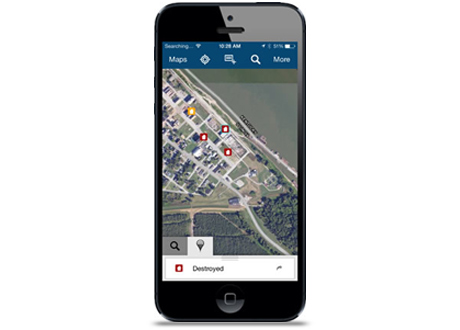
Collector for ArcGIS From documenting damaged transformers to identifying red- and yellow-tagged buildings, your staff can use the free Collector for ArcGIS app on Android or iOS smartphones to record conditions in the field. Take pictures and collect detailed information about structures or equipment, whether you’re within cell range or not. |