Turn Science into action
Understanding the interdependency of the earth’s ecosystems and human impact on the environment requires a great deal of information and analytical capacity. Doing something about it requires insight and collaboration. Esri ArcGIS technology allows you to do both. Esri supports all industries whose work touches environmental management. Government agencies, private businesses, and environmental organizations use Esri ArcGIS to turn science into action that meets the Earth’s major challenges.
Solutions
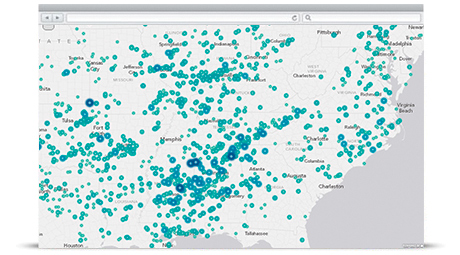
Create policy, implement regulations, manage enforcement, and repeat. You can effectively manage a broad scope of regulatory activities with Esri. Give staff better access to vital information and empower them to see areas of concern with geospatial intelligence. Staff have better access to vital information and clearly see areas of concern using geospatial intelligence. Whether measuring air quality in real time or regulating the movement of controlled waste, Esri helps you understand the problem and respond faster.
|
|
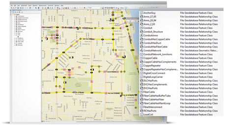
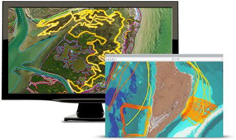
ArcGIS for Desktop Use ArcGIS for Desktop to manage the robust analyses required for regulatory projects. The brawn of the Esri suite, ArcGIS for Desktop does the heavy lifting for geospatial analysis. It builds 3D images, handles big data, and drives powerful models. |
| ArcGIS for Server The reach of an environmental agency is broad. ArcGIS for Server extends that reach by putting GIS into the hands of everyone in the agency. Staff can monitor real-time data, work in dynamic environments, and communicate with the public using online services. |
|
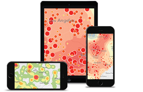
Twenty-first century technology captures massive amounts of data about your planet. Yet, finding that data and making sense of it can be overwhelming. Esri works with many organizations to standardize data and make it open for environmental analysis. You can monitor the community impact of pollution, weather, and hazards. You can also build online gateways with Esri technology that provide easy access to sensor and imagery data.
|
|
ArcGIS for Server Using ArcGIS for Server makes everyone across the agency more capable and efficient. It gives analysts the ability to discover, use, and share maps anywhere and from any device. Create web apps and give staff tools and apps that help them do specific tasks. |
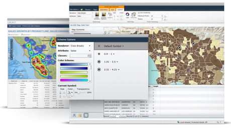
| ArcGIS Online Basemaps in ArcGIS Online provide the foundation for understanding environmental relationships. For example, you can add an urban forest data layer to an analysis about the city’s changing temperatures. Collaborate with others. Share your maps and data on your environmental web pages, blogs, and social media. |
|

People who plan and manage ecosystem restoration projects need tools to analyze data and carefully weigh their decisions. They must clearly understand all the ramifications of their projects. Esri technology brings authoritative data together and reveals problem areas. With intelligent maps, solutions become obvious. Analyze massive amounts of data to study trends. See how human modifications may affect the environment in the long run.
|
|
ArcGIS for Desktop Robust geospatial technology helps environmental agencies and consultants locate stressed areas and design remediation. ArcGIS for Desktop performs many types of complex geospatial analyses. You can assess ecological design scenarios to evaluate alternative restoration approaches. Monitor project status. |
| Collector for ArcGIS Use our Collector for ArcGIS web app to complete environmental inventory surveys. Set up a data collection form and make it available to your workers, along with a map. Take a snapshot of a corroded pipe, send it to the geodatabase, and add it to a map. |
|
Environmental mandates run the gamut from floodplain and mine land reclamation to natural disaster recovery programs. Esri supports consultants and engineers that help businesses comply effectively with these requirements. Check the status of the environment by using an environmental quality index rating. Use simulations and 3D visualizations to propose reclamation projects.
|
|
ArcGIS for Server Provide common ground with ArcGIS for Server. Mash up authoritative data and perform online geospatial analysis. Stakeholders can access project information and use web applications to do further analysis. When your project is online, you can access it and bring it into presentations for committees, workshops, and the community. |
| ArcGIS Online A portal to data, models, and maps, ArcGIS Online is the platform for analyzing environments and ecosystems. Web apps and maps improve collaboration with stakeholders. By publishing maps that anyone can access, you support the agency’s transparency mandate. |
|